Conducted comprehensive 3D mapping of eight significant archaeological features within the Ely Copper Mine project area, including the Washhouse, Village, and Sawmill, as part of the Superfund initiative. The project combined aerial and terrestrial imagery collection with advanced post-processing to seamlessly integrate data into the client’s established local grid system. This approach ensured high-accuracy documentation, mapping, and analysis of the project area, meeting rigorous quality standards.
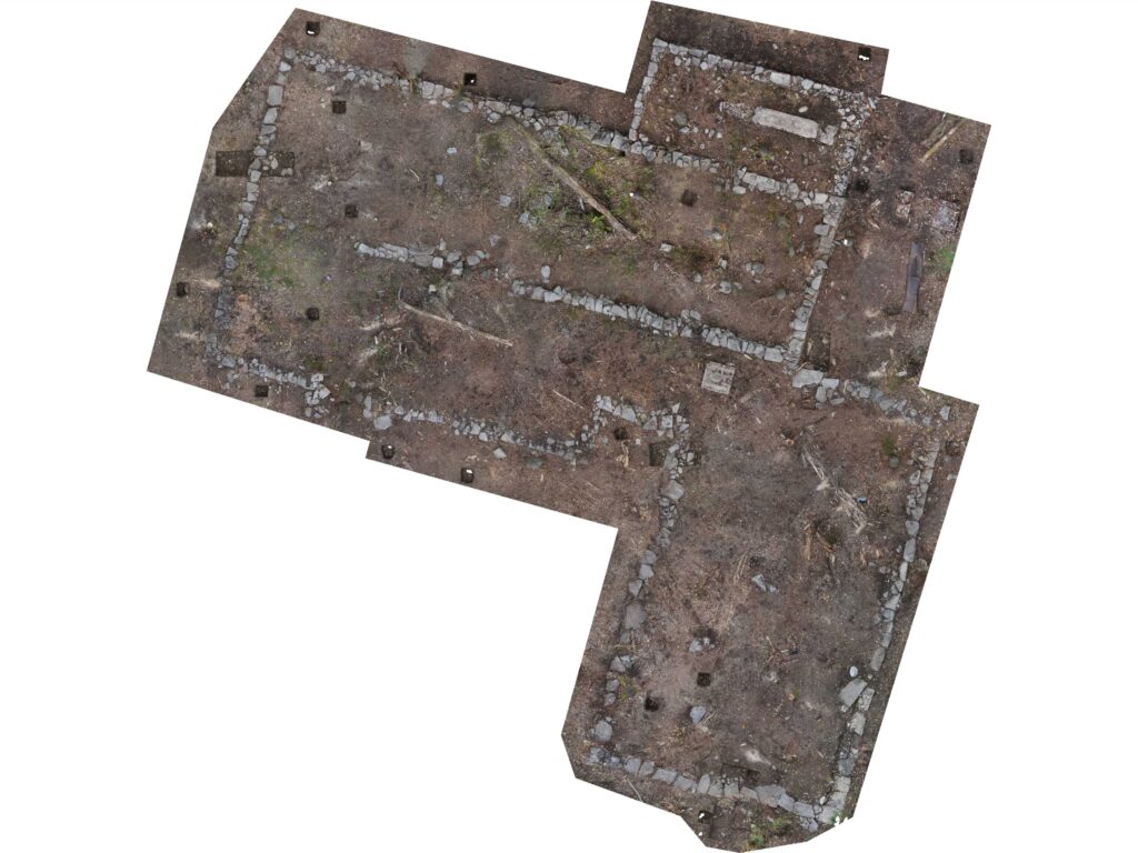
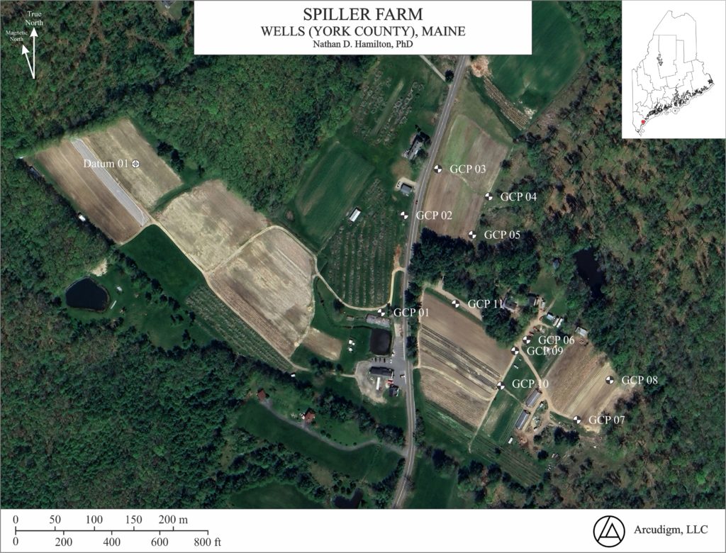
Archaeological Monitoring - Wells, Maine
Arcudigm recently completed aerial and terrestrial mapping of a 10,000-year-old Paleoindian archaeological site in Wells, Maine, a significant part of the state’s history. The project established a highly accurate site datum (±2 cm), enabling the creation of topographical and graphical models. These models will assist the University of Southern Maine in aligning archaeological maps from excavations conducted between 1995 and 2005 and support public outreach and education efforts.
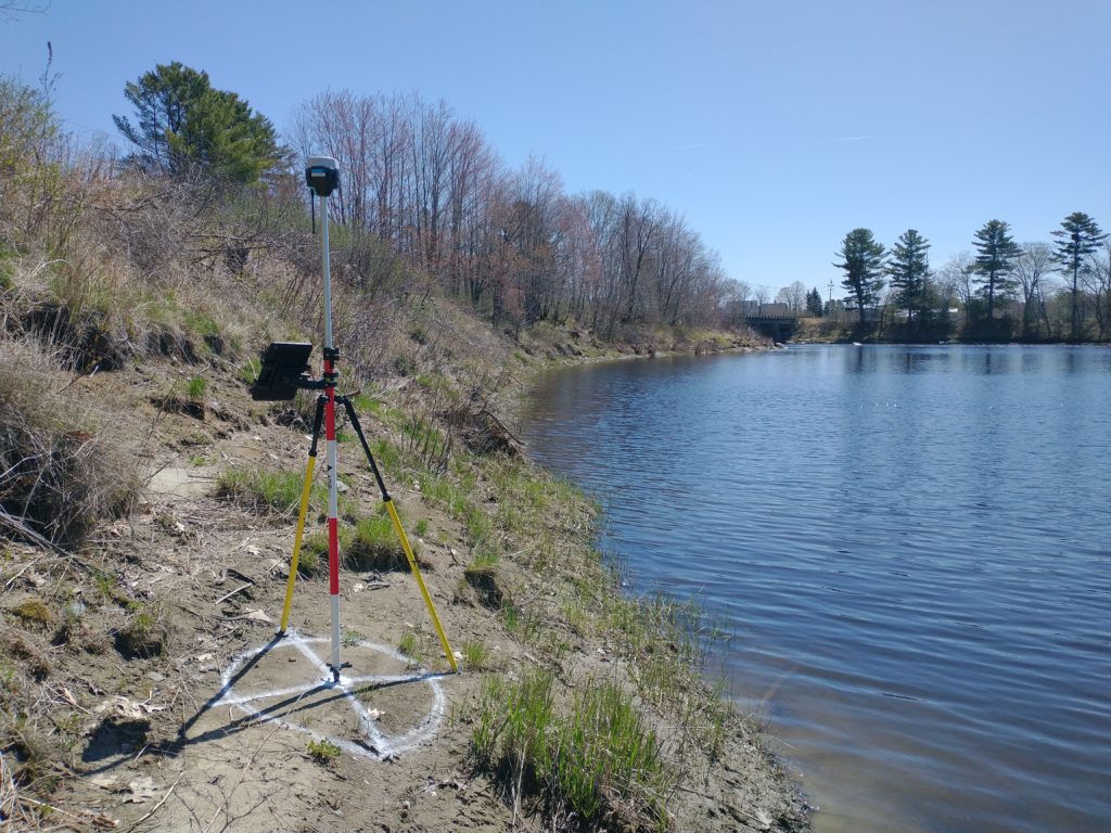
Archaeological Monitoring - Milo, Maine
Aerial and terrestrial mapping are essential for creating baseline models of current topography in cultural preservation efforts. These models help monitor river shoreline erosion, track changes over time, and assess risks to nearby archaeological sites. Understanding the rate and location of change enables cultural preservation organizations to make informed decisions, such as excavating high-risk sites, before irreversible damage occurs.
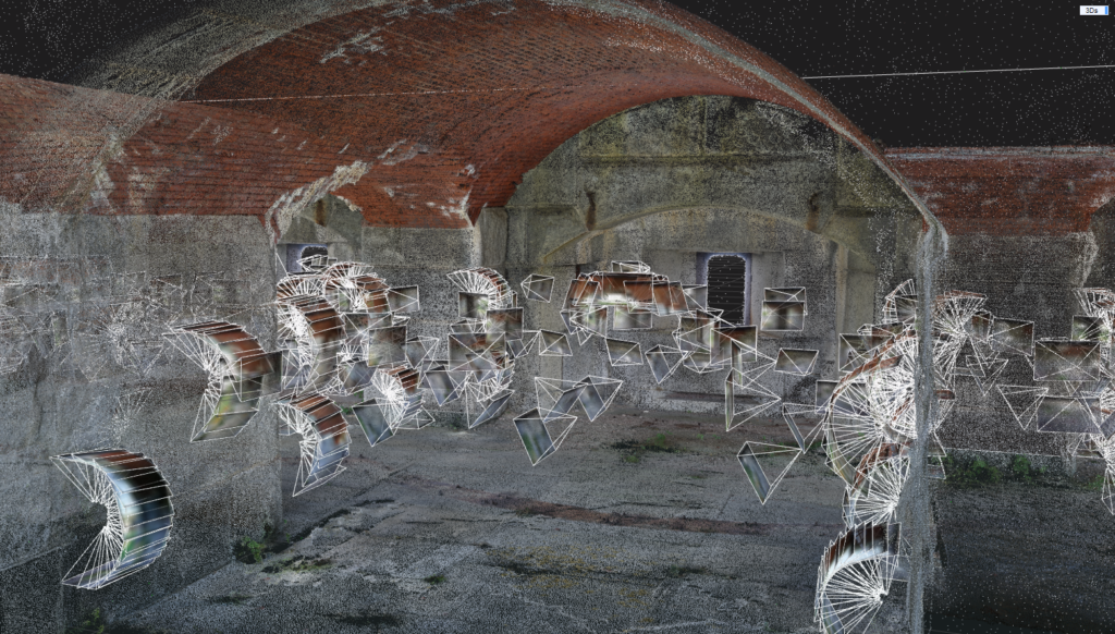
Digital Mapping of Fort Gorges - Portland, Maine
Arcudigm completed an aerial and terrestrial mapping project of Fort Gorges for the City of Portland, Department of the Interior, and Friends of Fort Gorges. This project successfully 3D documented the fort’s structural condition which will serve as a benchmark to monitor future structural change. This model will assist shareholders with future preservation/restoration projects (e.g., reinforcing and/or repairing collapsing cannon bays [gun casemates]) as well provide greater access to the public via virtual tours to this semi-remote piece of US and Maine history.
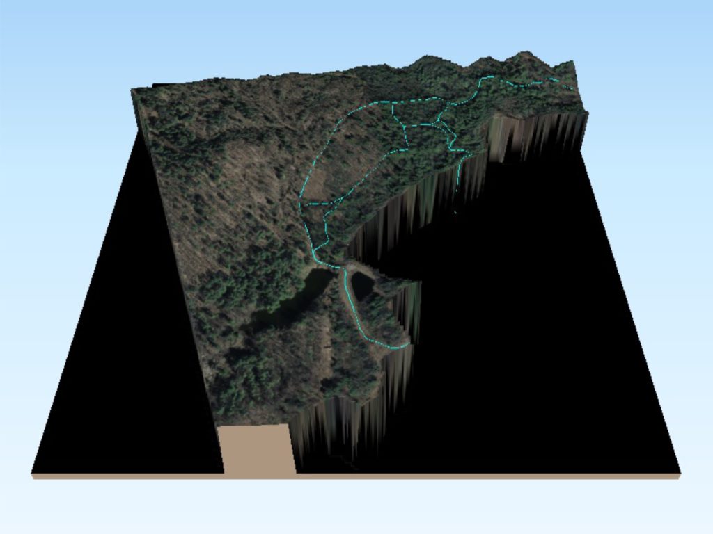
University of Southern Maine Smart Forest - Gorham, Maine
As a student, Arcudigm’s founder mapped the University of Southern Maine’s Smart Forest. This project included mapping the trail system, bridges, weather stations, and geocaching locations. The landscape reconstruction allows for spatial analysis to determine watersheds for monitoring erosion, storm water runoff, etc. as a tool to educate students and the general public of the various environmental implications.
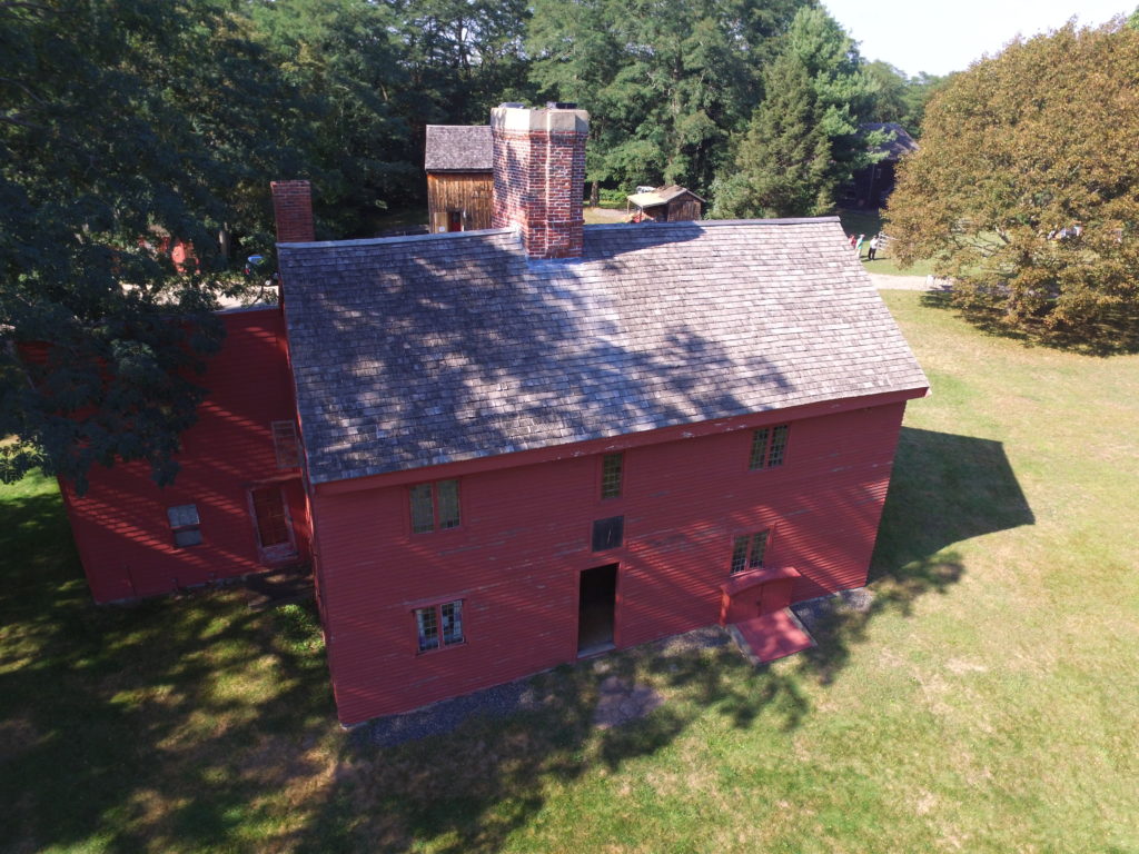
Rebecca Nurse Homestead - Danvers, Massachusetts
Small Unmanned Aerial Systems (sUAS), also known as drones, offer a perspective that is seldom seen and provides opportunities to visually represent the cultural and physical landscape through interactive digital media. The objective of the drone mapping operation was to collect data, post-process, and develop products used to educate and engage the public of the prehistoric and historical significance of the Rebecca Nurse Homestead in Danvers, Massachusetts.
The collected aerial data was then post-processed, developed into orthomosaics (2D maps) and 3D models, to be used by a student from the University of Southern Maine to develop an interactive, user-friendly, and educational virtual reality tour of the homestead. The data also provides educational and research opportunities as well as serves as a form of digital curation.
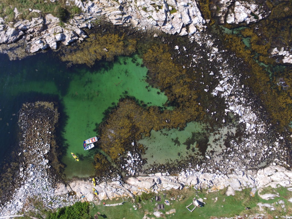
Rockweed Biomass Indexing - Isles of Shoals, Maine
The proposed Rockweed biomass indexing research project is being designed to develop economic and environmental sustainability in the state of Maine’s seaweed industry which can later be applied to other communities. The project will include surveying the Taunton Bay area (near Bar Harbor, Maine) using a multi-spectral sensor, post-processing aerial images into a orthomosaic, and analyzing the orthomosaic’s near-inferred pixel values to calculate plant and species health, quantity, and location.
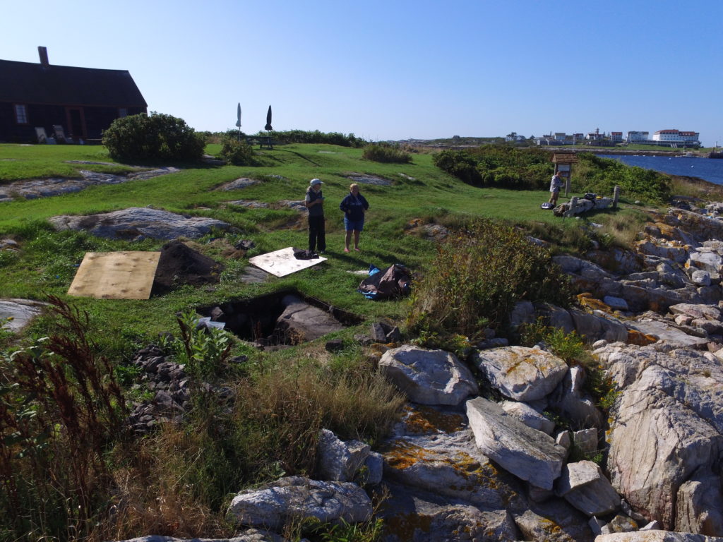
Malaga Island - Isles of Shoals, Maine
The Isles of Shoals, located 8-miles off the New Hampshire and Maine coast, case study demonstrates the diverse UAS applications for environmental, precontact, and historical research. The Malaga Island case study primarily focused on archaeological site risk assessment due to sea level rise and erosion. This was achieved through data collection and post-processing to produce a highly-realistic orthomosaic and digital elevation model (DEM) to perform an assortment of geospatial analysis. The project looked at the 100 year sea level rise prediction (low, medium, and worst case scenario) in order to provide stewards the necessary information to make informed decisions regarding site preservation. This data also serves as a form of digital curation as well as provides research and educational opportunities.
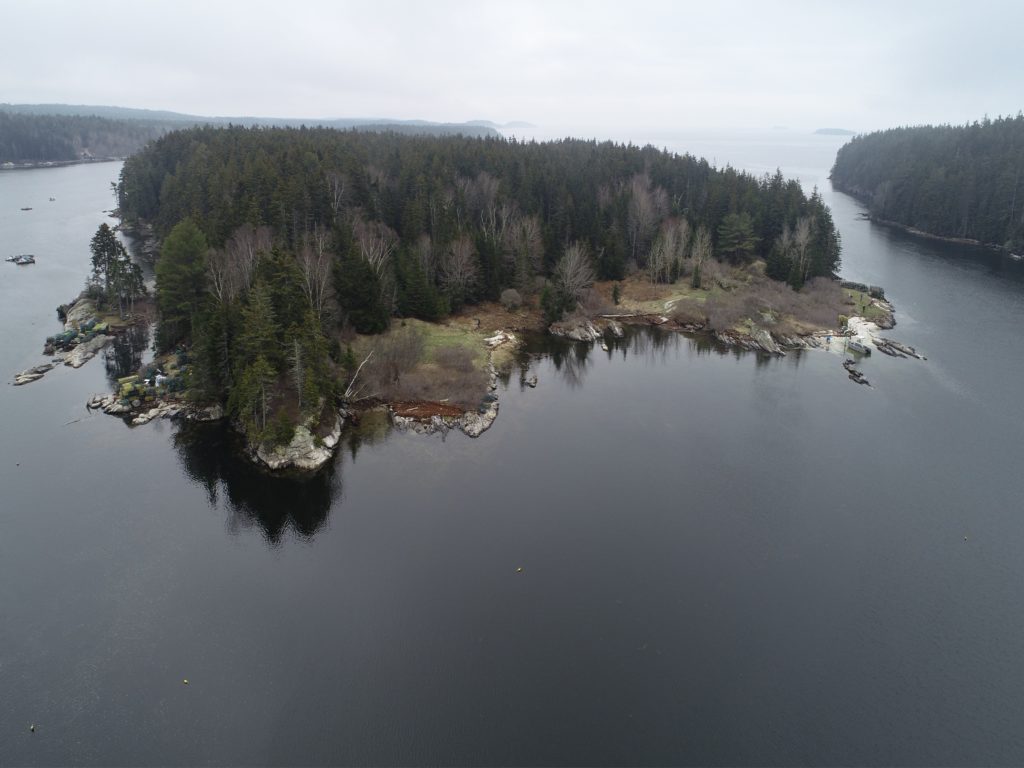
Digital Mapping of Malaga Island - Malaga Island, Maine
Malaga Island has a deep human history, spanning from Native American (First Nations) and post-contact inhabitants. From an archaeological perspective, there is more known “about Malaga’s later residents – a mixed-race community that occupied the island’s north end from the mid 1800s to 1912 when the State forcibly removed them” (citation). Nathan D. Hamilton, PhD, Associate Professor of Archaeology at the University of Southern Maine coordinated the mapping project with Maine Coast Heritage Trust (island’s owner and stewards). The mapping project was conducted to develop high-resolution data for site risk assessment and educational tools for public outreach as well as digital preservation.