A multifaceted geospatial mapping and analysis firm
Arcudigm specializes in geospatial mapping and analysis to make informed decisions to improve the world around us
C O N S U L T I N G
Each project has unique requirements, budgets, and locations so we provide expertise in grant writing, planning, and coordination every step of the way.
M A P P I N G
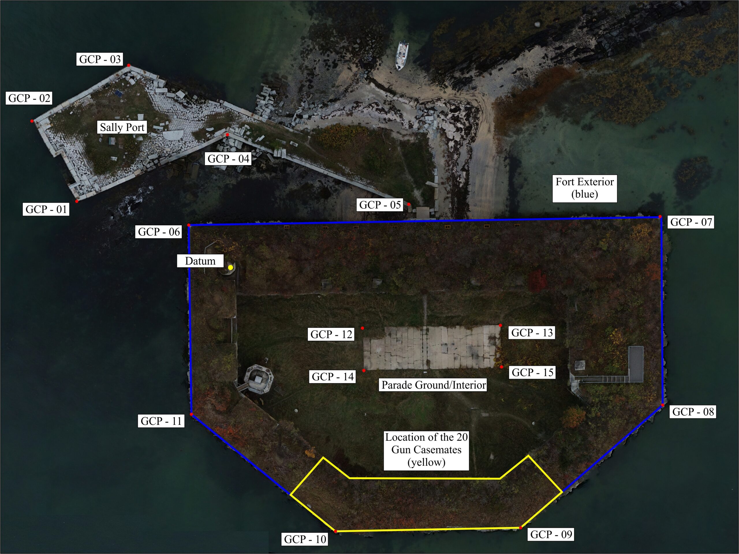
Geospatially accurate aerial and ground data as well as ground control points (GCPs) to provide multispectral structural, land, and coastal data.
A N A L Y Z I N G
We provide an array of data manipulation and interpretation processes to provide our clients with greater insight, value, and understanding of their data.
View some of our dataset capabilities used for in-depth analysis and reports to assist you in the decision making processes
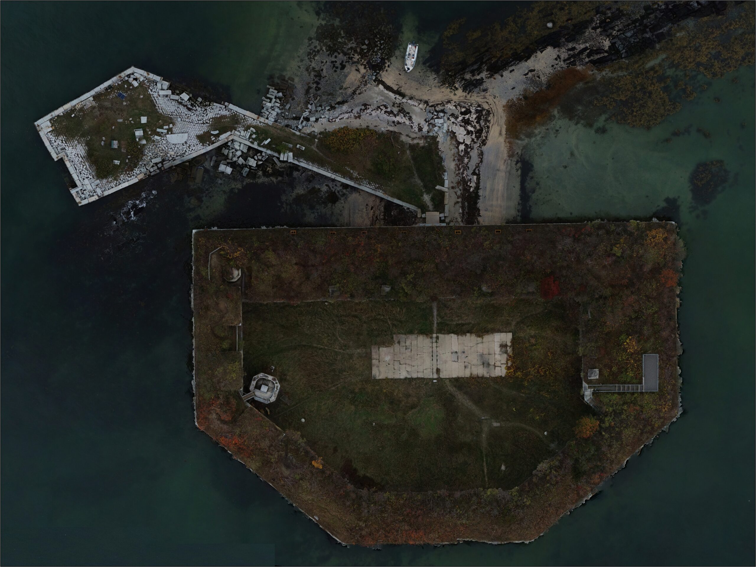
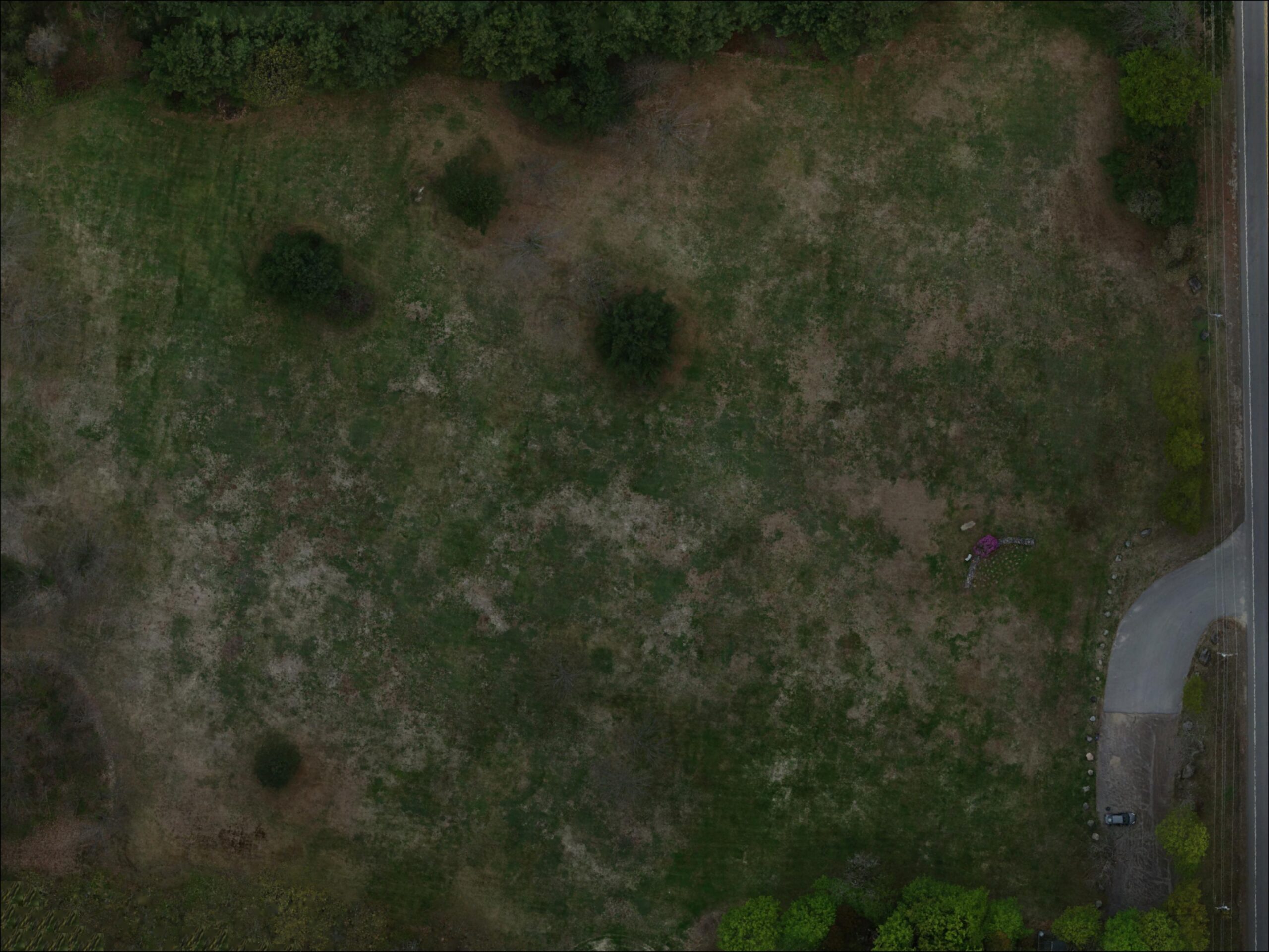
Orthomosaic
Geometrically corrected aerial photographs that have been georeferenced and stitched into a singular uniformed and highly-accurate geospatially scaled map.
Normalized Difference Vegetation Index (NDVI)
Quantifies vegetation health by measuring the difference between near-infrared (vegetation strongly reflects) and red light (vegetation absorbs).
Normalized Difference Red Edge (NDRE)
Sensitive to chlorophyll content in leaves, variability in leaf area, and soil background effects. Effective for determining tree and higher canopy vegetation health.
Digital Terrain Model (DTM)
Raster image containing cells which represents elevation values (z-values at regularly spaced intervals) that are reflective of ground elevation (the removal of trees, buildings, brush, etc.).
Digital Surface Model (DSM)
Raster image containing cells which represents elevation values (z-values at regularly spaced intervals) that are reflective of ground and objects (trees, buildings, brush, etc.).
Normalized Digital Surface Model (nDSM)
Raster image containing cells which represents elevation values (z-values at regularly spaced intervals) that are reflective of absolute heights of features above the earth’s surface.
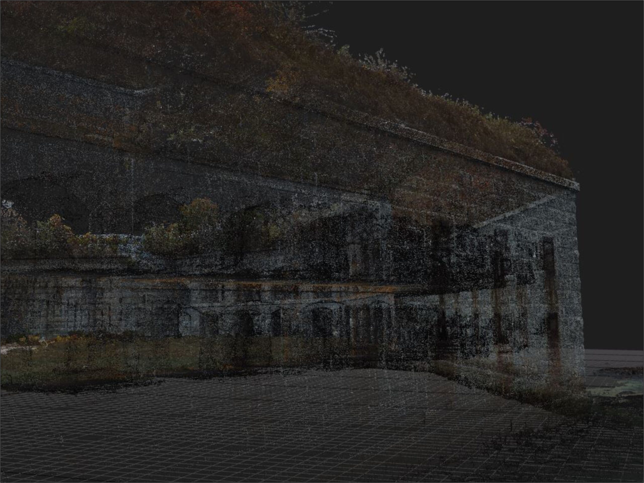
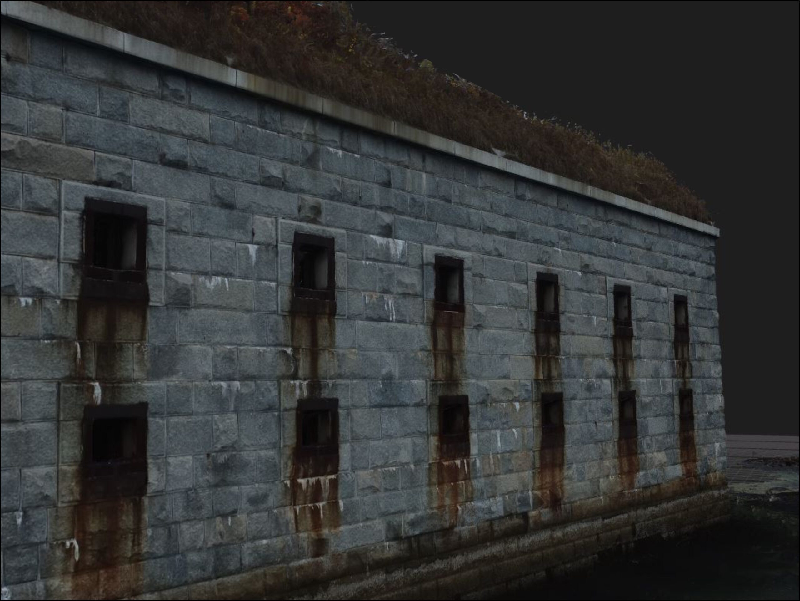
Point Cloud
A compact or dispersed collection of data points in a local or universal coordinate system (X, Y, Z) which represent the the external surface of anobject or landscape.
Three-Dimensional (3D) Model
Mathematical representation of the interior or exterior of an object’s or landscape’s surface in three-dimensions to create a highly-photo-realistic representation.
Accurate, fast, and cost-effective
High-resolution aerial and ground data to make quick, informed, and cost-effective decisions to resolve everyday problems delivered in an easy to use client interface. We offer a wide array of services for the cultural heritage, preservation, agricultural, forestry, construction, engineering, and other industries to help our clients make the most out of their data.
Monitor sites with centimeter resolution and accuracy for erosion, invasive species, progress, preservation, and more.
Graphics and Site Planning
High resolution graphics and site plan overlays for planning, monitoring, managing, and more.
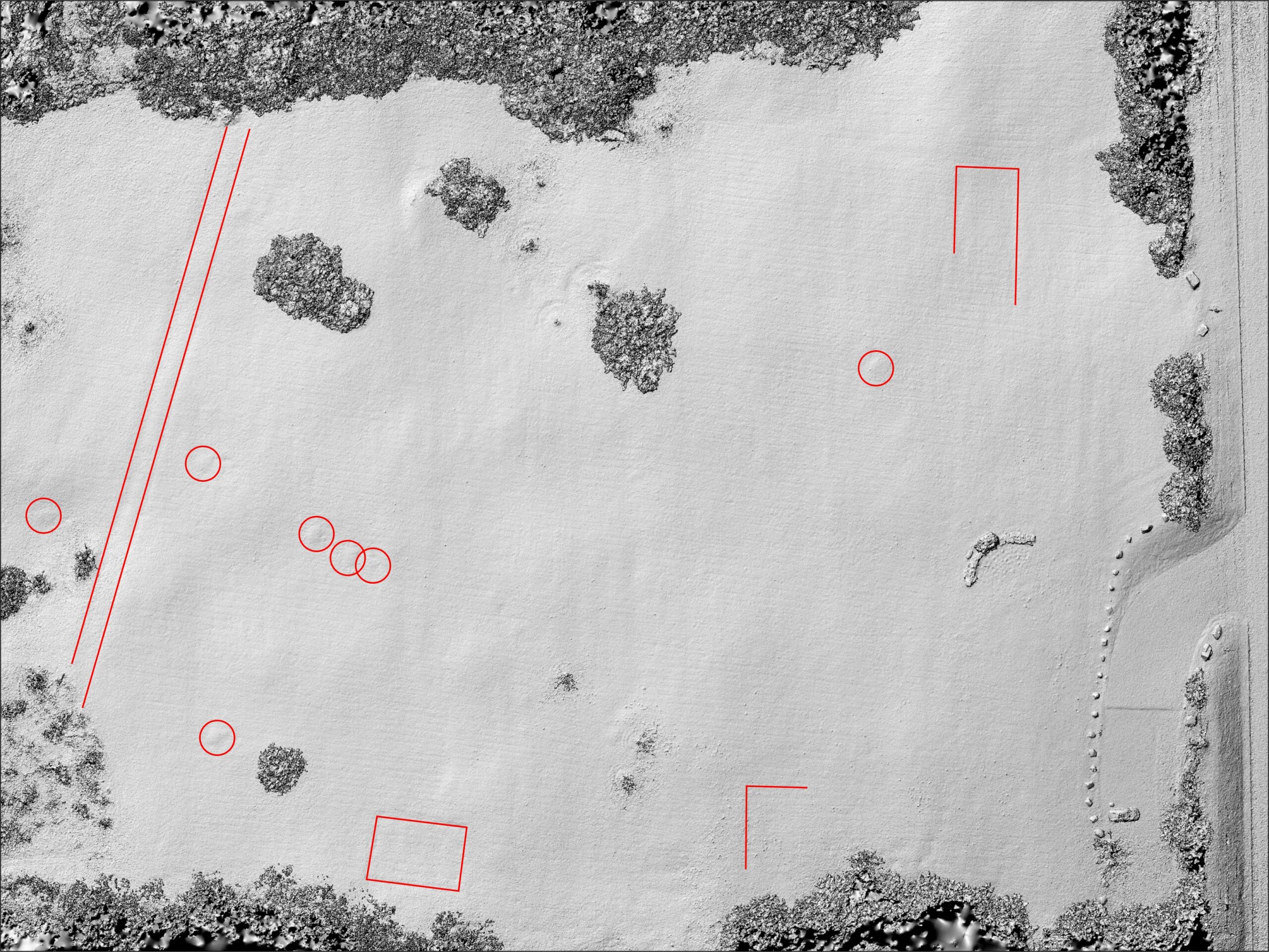
identify sub-soil features
Identify sub-soil features by isolating cultural geometrical shapes by measuring the difference in elevation values.
View some of our geospatial forms of analysis for a variety of applications to help you get the most out of your spatial data
Volumetrics
The measurement of depression and protrusion volume.
Coordinates
Obtain an object’s three-dimensional location (local or universal grid).
Contours
Represents a landscape’s topography (steepness or gentleness of slopes).
Watershed
Delineate the local topographical area that drains into a single catch basin.
Measurements
Measurements that represent size, length, circumference, or elevation.
Vegetation Health
Perform crop, tree, or vegetation health analysis using NDVI and NDRE datasets.
Slope
Calculate the pitch and angle of terrain as well as features in the landscape.
Aspect
Determine landscape and/or feature orientation represented in degrees.
Plant Speciation
Isolate and identify the various forms of vegetation within the same area.
Tree Count
Identify the number of trees within a project area to get accurate counts.
Site Monitoring
Document site conditions and monitor change over time (project phase, seasonal, etc.).
WHAT OUR CLIENTS SAY
"[Arcudigm is] responsive, flexible, and good at integrating their overhead photography and digital mapping capabilities into ongoing projects."
Arthur Spiess, PhD - Senior Archaeologist for Maine Historic Preservation Commission
"Arcudigm produced a high-quality report and was able to obtain images of mid-river features that were inaccessible to our survey crew... [and] demonstrated to Independent Archaeological Consulting that Arcudigm can successfully bring a challenging project to completion."
Jessica A. Cofelice, MA – Owner and Project Archaeologist for Independent Archaeological Consulting, LLC
"Arcudigm's assistance with this new technology provided a view of our proceedings I had long desired, but for which lacked the expertise and equipment."
Kathleen L. Wheeler, PhD – Former Owner of Independent Archaeological Consulting, LLC